The Grigsby Riffle
The Grigsby Riffle is a natural geologic feature of Cache Creek located approximately three miles upstream of the Cache Creek Dam near the town of Lower Lake. The Grigsby Riffle is a rock formation that acts as a bottleneck and restricts the amount of water that can flow over it. The outlet channel, restricted by the Grigsby Riffle, is too small to allow floodwaters to leave the lake as fast as it enters, and it limits the amount of water that the District can release from Cache Creek Dam during flood events on Clear Lake. This is demonstrated by the fact that the highest recorded level on Clear Lake was prior to the construction of Cache Creek Dam, when the lake reached 13.66 feet in 1890.
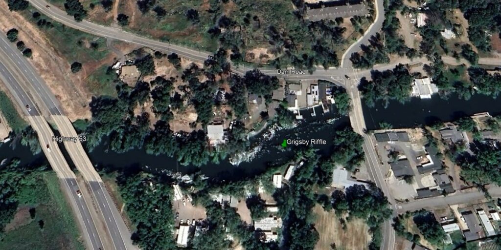
The Cache Creek Dam was designed and constructed with the assumption that the Grigsby Riffle would be enlarged to accommodate greater flows out of the lake. However, during periods of drought, the citizens of Lake County prevailed in court to halt efforts to enlarge the riffle. Later, during periods of intense rainfall, when it was desirable to lower the lake faster to prevent flooding, residents along Cache Creek in Yolo County prevailed in court to keep the riffle from being enlarged. This court case resulted in the Bemmerly Decree, named after the sisters Agnes and Mary who brought the case. This decree mandated that the size of the Grisby Riffle be maintained as it was at the time of the court decision.

The Rumsey Gauge
When discussing managing the waters of Clear Lake, it is helpful to have a brief explanation of the unique gauge and terminology used for measuring the level of the Lake. Almost all lake levels are described by the water elevation compared to mean sea level (MSL), the average elevation of the ocean’s surface, but Clear Lake is different. In 1873, a cattle drive captain named DeWitt Clinton Rumsey decided that when water ceased to flow over the Grigsby Riffle, that would be zero on the Rumsey Gauge. It took many years to determine the elevation that constituted a full lake. The determination of a full lake was included in the Gopcevic Decree at 7.56 feet Rumsey, because that was the average high-water level between 1873 and 1920. The Gopcevic Decree also formalized Zero Rumsey as 20.01 feet below the center of the large concrete star at the northeast corner of the courthouse yard in Lakeport, which is equivalent to 1318.26 feet MSL.
Although the Rumsey Gauge measurement refers to the water height above the Grigsby Riffle, located near Lower Lake, Captain Rumsey established the gauge near the town of Lakeport, where it is still located today. Of course, the gauge has been replaced with modern technology and is operated by the U.S. Geological Survey (USGS). The gauge and can be accessed on their website which is linked below and the lake level is updated four times per hour.